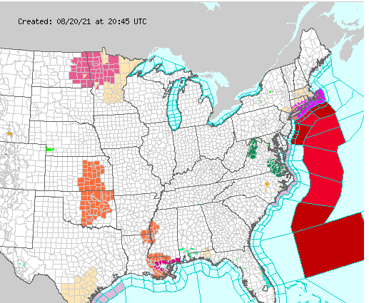
NORTHERN RI – Locals are advised to prepare for potential flooding and high winds as Tropical Storm Henri makes its way toward the state, with landfall expected on Sunday.
According to the latest update from the National Weather Service, the storm continues to move west with landfall edging closer northern Rhode Island.
Gov. Dan McKee issued an update Friday afternoon with Emergency Management Director Marc Pappas, who said he had received an update from the NWS around 3 p.m.
“It has changed dramatically in the past 12 hours,” Pappas said. “It continues to track to the west.”
“It’s moved about to where Connecticut and Rhode Island meet,” Pappas said. “The problem with this storm is it seems to want to slow down instead of speed up. The more it slows down the more it will rain.”
“The impact of storms like this can extend far from the coast,” Pappas warned.
Tropical storm force winds are currently expected to arrive Sunday morning and peak Sunday afternoon with gusts of 70-80 miles per hour along the coast. Inland, Pappas said to expect winds between 40 and 50 miles per hour.
Pappas said state officials will continue to track intensity and timing.
“Things are changing,” he said.
McKee said that National Grid has prepared 200 line crews to restore potential outages. State beaches and parks, he said, will be closed on Sunday, Aug. 22, and likely on Monday, depending on damages.
“Take the time to ensure you and your family are prepared,” McKee said.
North Smithfield residents who have internet access can log onto the town website for Emergency Management at www.nsema.org and get up to the minute situation reports as part of a new Emergency Information Network. They can call also the NSEMA office at (401) 767-2206 for info or help during or after the storm.
Burrillville residents are advised to sign up for CODE Red alerts and find additional info on the town website at https://www.burrillville.org/police-department/pages/emergency-info-codered
An additional list of preparedness efforts sent out by the North Smithfield Emergency Agency can be found below.
Hurricanes can cause power or water supply failures. NSEMA recommends checking battery powered equipment such as flashlights and radios now, noting that a battery radio could be the only source of information in a hurricane emergency. Residents should also store a supply of drinking water in a clean bathtub, jugs and cooking utensils because the town’s water supply could be contaminated by the storm or not be able to supply water if the system water pumps do not have power to run them. Those with private wells will also have water supplies cut off if they have an electric powered well pump.
Fill your car’s fuel tank to be prepared in case evacuation should occur. There is also a possibility that service stations may be inoperable after a storm if power is cut off.
Board up windows or protect them with storm shutters or tape. Danger to small windows is mainly from wind driven debris. Larger windows may be broken by wind pressure. Although tape may not prevent flying debris from breaking windows, it will prevent flying glass from causing injury to persons in the home or outside.
Secure outdoor objects that might be blown around. .Garbage cans, garden tools, toys, signs, porch furniture and a number of other harmless items become weapons of destruction in hurricane winds. Boats should also be moored securely or moved to a designated area before the storm arrives.
Residents living near small streams or rivers should keep on guard for flash floods caused by high rainfall caused by the storm.
If local authorities or Emergency Management officials advise evacuation of your area, do so immediately. Keep your car radio on to listen to further instructions, such as the location of North Smithfield’s Emergency Shelters.
As you monitor Weather Service Advisories be alert for tornado watches or warnings. North Smithfield has already experienced a tornado in recent history and NSEMA notes that no area is exempt from this severe wind storm. Tornadoes are often caused by hurricanes. Should your area receive a tornado warning , seek inside shelter immediately , preferably below ground level.
Once the hurricane has reached your area, remain indoors. Blowing debris can injury you or kill. Travel is extremely dangerous. Be especially wary of the “eye” of the hurricane. If the storm center passes overhead, there will be a lull in the wind blowing lasting for a few minutes to half an hour or more. At the either side of the “eye” winds will increase rapidly to hurricane force and will come from the opposite direction..
If the hurricane forces you into public shelter stay there until the storm passes.
Keep tuned to your local radio or television station for advice and instructions from local government about emergency medical, food, housing and other forms of assistance.
Do not drive unless you must. Debris filled streets are dangerous and roads should be left clear for emergency vehicles. In addition your presence in the disaster areas might interfere with essential rescue and recovery work. Along the coast, soil may be washed from beneath the pavement, which could collapse under the weight of a car.
Avoid loose or dangling wires and report them immediately to your local power company, your local police or fire department. If you have a citizens band radio you can contact REACT on CB channel (9) to report any storm related problems you may encounter on the road or highway. Report any broken sewer or water mains to the water department. Be particularly careful to prevent fires as lowered water pressure may take away necessary water pressure from mains for fire fighting.
Be careful of water which may have become contaminated. If the power has been off, check refrigerated food for spoilage. A freezer should keep food in satisfactory condition up to 36 hours, provided it is kept closed. Wrapping the freezer in blankets will help insulate the cold.
NSEMA advises that you discuss this information with your children and explain your family’s plans and preparations while also sharing your ideas with friends, neighbors and relatives. Additional information on hurricane preparedness is available at the public safety center or from your local Emergency Management Officials.


